From pixels to proof — expert intelligence on demand
Satellite imagery on request for indisputable evidence.

The verifiable source for maritime satellite intelligence
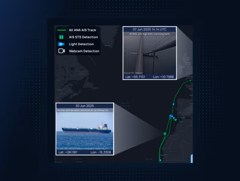
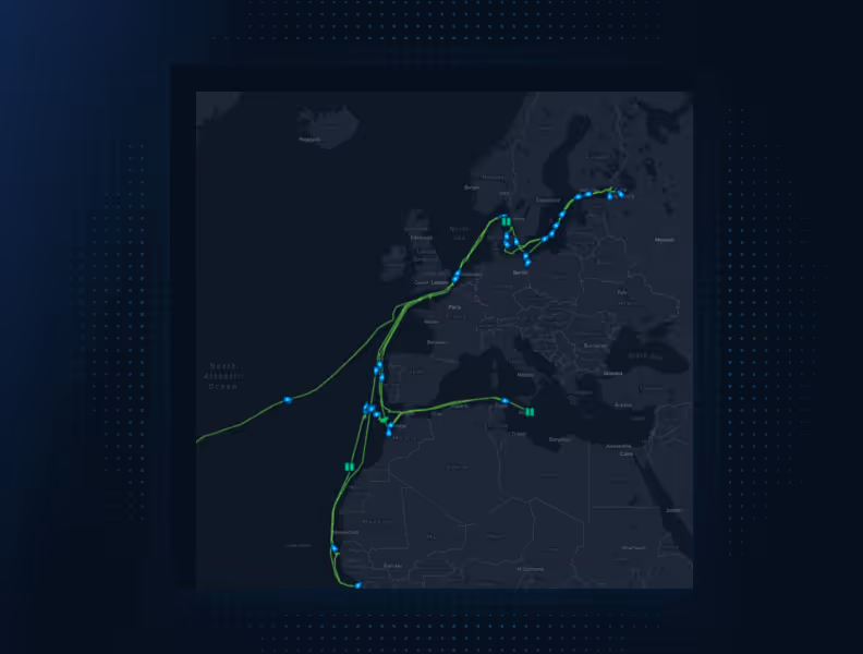
Satellite Intelligence Report is an on-demand intelligence service built directly into Seasearcher. Powered by SynMax, it fuses satellite imagery, AIS cross-validation, SAR radar, and 10+ contextual databases giving legal, claims, and compliance teams expert-verified, time-stamped intelligence you can rely on to resolve high-stakes maritime cases.
- Time-stamped imagery
- Available within Seasearcher
- Expert-verified analysis
.avif)
Trusted by thousands of customers worldwide


The most indisputable intelligence available
Expert-validated intelligence drawn from satellite imagery, SAR radar, AIS cross-validation, and 10+ contextual databases — pinpointed to exact latitude, longitude, and date. Independently produced and cross-verified across multiple data sources — clear, credible, and built to hold up in legal, claims, and compliance settings.
Request intelligence without leaving Seasearcher
Request Satellite Intelligence Reports directly from maps, compliance screening, or incident pages — no new tools, no extra training, no external workflows. It fits the way you already work.

Only pay for intelligence that delivers
No subscriptions, no hidden costs. Request a report when you need it and pay only when the intelligence delivers. If imagery is unusable due to cloud cover, there′s no charge — so you′re never billed for data that doesn′t deliver.
Put accuracy at the heart of every case
The on-demand intelligence service you can rely on built directly into Seasearcher.

.jpg)

%20(15).png)
.avif)
.avif)
.avif)
.avif)
.avif)