Proprietary AIS infrastructure powering global vessel tracking
Delivering trusted vessel intelligence from a purpose-built global AIS network.

The foundation of global vessel tracking intelligence
Reliable vessel tracking starts with strong data infrastructure.
Fragmented AIS feeds, inconsistent coverage, and delayed updates create gaps that reduce confidence in maritime intelligence. Without a robust collection network, visibility across voyages, ports, and trade routes becomes unreliable.
Lloyd’s List Intelligence operates a proprietary terrestrial AIS network designed to deliver precision, reliability, and global coverage. Spanning more than 12,000 ports worldwide, the network provides over 70% of AIS positions and forms the backbone of maritime tracking intelligence.
Combined with satellite AIS, shipborne signals, and validation technology, this infrastructure delivers consistent, high-quality vessel tracking across coastal and offshore regions.

75,000+
mapped maritime locations validated and maintained
750m+
AIS messages processed and quality-checked daily
98%+
of AIS positions from terrestrial and shipborne network
Proprietary terrestrial AIS network
The AIS network is built on a global infrastructure of land-based receivers positioned across strategic ports and coastal locations. This terrestrial coverage delivers high-frequency updates, improved accuracy, and reliable tracking in high-traffic maritime corridors.
Direct relationships with AIS hosts enable real-time monitoring, rapid issue resolution, and uninterrupted data flow across the network. Continuous optimisation ensures coverage improves as new stations are added.

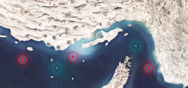
Closing the gaps: Shipborne AIS
Maritime operations are fluid, crossing borders, seas, and zones where terrestrial coverage isn’t always enough. This is where shipborne AIS steps in, ensuring that critical data gaps are filled, even in high-traffic or remote areas.
Shipborne receivers, positioned onboard vessels, work tirelessly to collect and transmit positional data. By operating closer to the source, they provide more frequent updates, minimise latency, and reduce message collisions. This complementary layer of data ensures continuity and improves the quality and reliability of maritime intelligence.

Blended terrestrial, shipborne, and satellite coverage
Terrestrial AIS provides high-quality coastal tracking, while satellite AIS extends visibility across deep ocean regions.
This blended approach improves accuracy, reduces gaps, and strengthens detection of anomalies such as AIS outages or suspicious routing behaviour.

Hosted by trusted maritime partners
AIS receivers are hosted at strategic maritime locations including ports, terminals, and coastal infrastructure. These partners extend coverage and improve regional intelligence.
Network expansion is continuous, with new stations integrated to improve signal quality, reduce blind spots, and enhance global coverage.

Continuous network optimisation
AIS infrastructure is monitored continuously to ensure uptime, signal quality, and coverage reliability. Performance analytics identify gaps and support targeted network expansion.
As additional terrestrial stations and satellite feeds are integrated, vessel tracking intelligence becomes more complete and resilient.

Become an AIS Network Partner
By joining the network, partners support real-time vessel tracking and help enhance decision-making across the global shipping industry.

Help power global maritime intelligence
Organisations can host a Lloyd’s List Intelligence AIS receiver and become part of the global AIS network. Partners contribute to maritime safety, security, and commercial intelligence while strengthening coverage in their region.
Partner benefits
- Improve maritime safety and transparency
- Contribute to global vessel tracking coverage
- Support compliance and risk monitoring
- Join a trusted maritime intelligence network
- Strengthen regional AIS visibility
How it works
- Install AIS receiver at your location
- Transmit vessel signals to the network
- Signals validated and integrated into AIS intelligence
- Coverage improved for your region and globally
AIS Infrastructure built for Maritime Intelligence
The AIS network forms the foundation of vessel tracking, risk detection, and voyage intelligence. By combining proprietary terrestrial infrastructure with satellite coverage and global partners, maritime visibility becomes more accurate, resilient, and complete.


.avif)

.avif)
.avif)