skip to main content
Global Search Configuration

Speak to us about your AIS needs

550K

unique vessels tracked across class A and B fleets

95%

of positions are from our terrestrial and shipborne network

97%

uptime across our network

74K

places covered including 12k ports, 16k terminals and 43k berths

What Is AIS SeaOrbis?

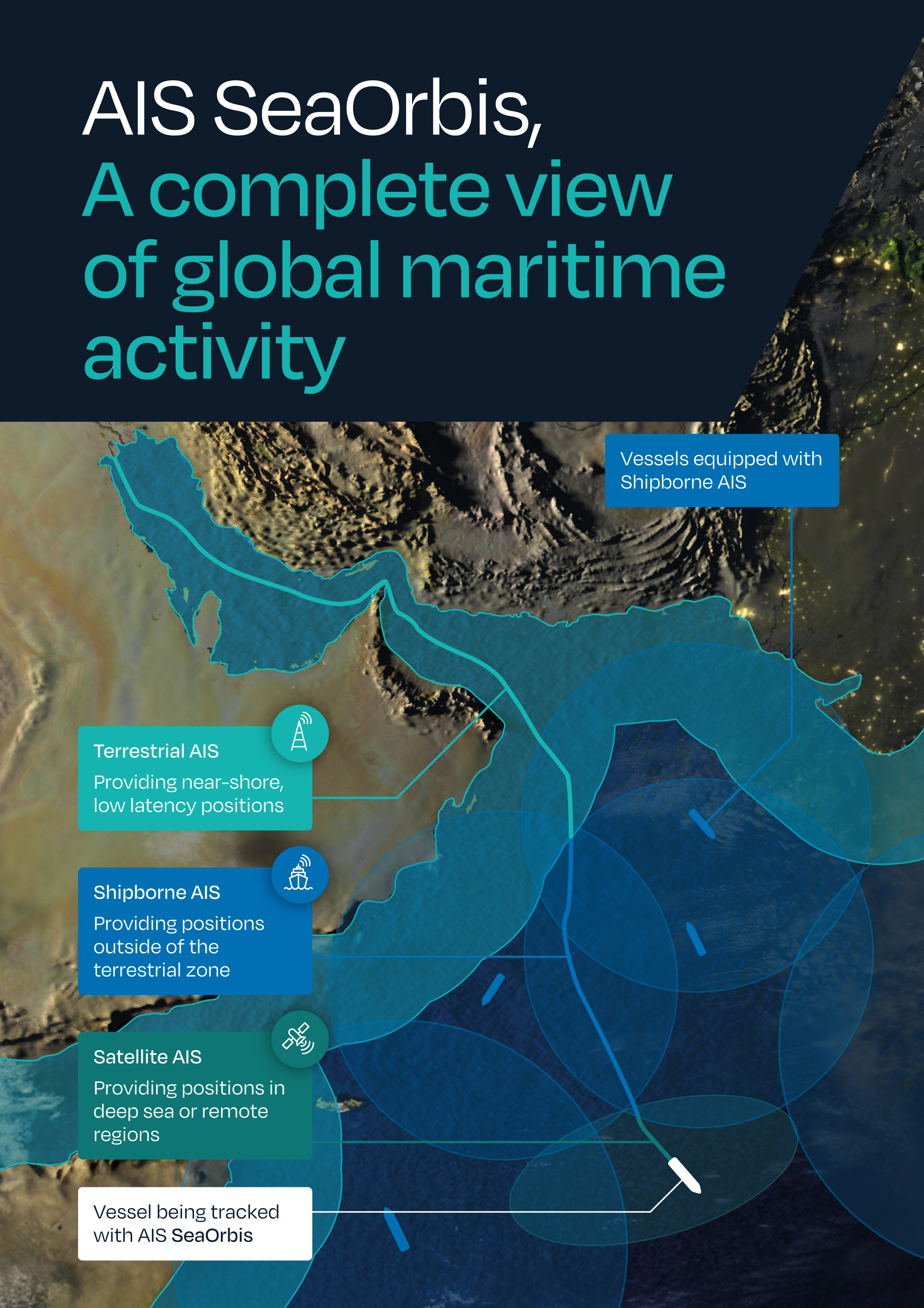
Image showing "Terrestrial Network, Satellites, Lloyd's Agency Network and Shipborne Receivers"

AIS SeaOrbis is more than just raw vessel AIS data – it’s the contextualised movements intelligence you need to make data-driven decisions for your business.

By combining terrestrial, shipborne, satellite, and human intelligence with our global, geospatial database, we capture near-shore and off-shore vessel movements, overlaying unique AI models to provide pin-point accurate insight on historic, current, and predicted vessel movements.

Unrivalled data quality

Big data is everywhere, no more so than in the maritime industry, and cutting through the sheer volume to get to the information you need can seem like a daunting task.

We’ve done the hard work for you, having processed, and verified data from over 3,000 sources. Our commitment to data quality and continual improvements to our analytics model enable you to track the global shipping fleet effectively while safeguarding your operations

Governed by an ISO9001 accredited framework, our AIS data models deliver exceptional quality and consistency. Our COACT framework delivers on 5 key areas, and in combination, ensures our AIS data is the best in class.

COACT_updated

A unique blend of data sources

2HPDBGY-orig

Terrestrial

We staff, manage, and maintain our own terrestrial AIS network covering 12,000+ ports, which provides more than 80% of all our AIS positions through our exclusive partnership with the Lloyd’s Agency Network.

Shipborne

We have a network of Shipborne receivers, positioned onboard vessels that work tirelessly to collect and transmit positional data. By operating closer to the source, they provide more frequent updates, minimise latency, and reduce message collisions. This complementary layer of data ensures continuity and improves the quality and reliability of maritime intelligence.

Satellite

For the open ocean, we have partners who provide satellite AIS, complementing terrestrial and shipborne data by extending coverage to areas beyond the reach of land-based or onboard systems. This layer of data helps fill in gaps and supports a more comprehensive view of vessel movements when needed. 

Verified by humans

LloydsPrimaryLogo

Our exclusive partnership with the Lloyd’s agency network provides a unique layer of human validation to our ports and positions data.

Our exclusive partnership means:

  • Insight and intelligence from over 250 Lloyd’s Agents, and a further 300 sub-agents in 170 countries
  • Our AIS network, hosted by the Lloyd’s Agents, is present in most of the world’s trading ports and in strategic and sensitive locations where other providers do not have access
  • We have an enhanced ability to detect AIS spoofing and other deceptive shipping practices thanks to real-life sightings and unrivalled station uptime

Lloyd’s List Intelligence has one of the most precise and accurate [terrestrial AIS networks], because they can benefit from a historical association with the Lloyd's Agent Network.

Software provider to the maritime industry and Lloyd’s List Intelligence partner

Geospatial database

GB Database

Our geospatial database is the most structured and granular port database available. It uses a clear hierarchy of port locations and more intricate ‘polygons’ to provide complete coverage and unparalleled accuracy.

Our Geospatial database allows you to:

  • Maximise the value and vessel movements data
  • Understand vessel movements covering global ports, sub-ports, terminals, berths and STS areas in unparalleled detail.

Powerful data solutions in the format that's right for you

2YRMAJ8

Seamless Integration

Streamline your workflow and improve operational efficiency by integrating our data directly into your analytics workflows reducing the need for manual data pulls

Bespoke Delivery

Customisable data extracts with data elements, structure and frequency tailored to your needs

Historical Analysis

Continuous and consistent historical AIS data going back to 2010 can inform historical vessel movement and trade lane trends

On-demand Access

Snowflake and our APIs provide flexible and continuously updated data delivery solutions providing an efficient and customisable alternative to traditional file delivery

Thank you for providing your details

We will call you back as soon as possible.

Terms and Conditions

Privacy Policy    Terms & Conditions

When submitting a form, we request some personal details, including a work email address. In addition to supporting your query, this data is used for marketing purposes by Lloyd’s List Intelligence. This processing is carried out based on our legitimate business interests. Being able to promote our events, products, and services to interested parties allows us to grow and develop our business.

You can unsubscribe at any time by following the links in any marketing emails we send to you or by emailing updatemydetails@lloydslistintelligence.com. For full details on how Lloyd’s List Intelligence processes your personal data please see our Privacy Policy.